ENEnglishFRFrançaisESEspañolPTPortuguêsعالعربيةفافارسیIDBahasa
GPS & Adventures — for Android

Every ride, recorded in extraordinary detail.

Turn every hike, ride, run or road trip into a richly detailed, shareable story. More than a line on a map: live metrics, geotagged photos, cinematic videos, PDF reports — and an SOS lifeline when it matters most.

50,000+ downloads · No account required · Recording uses zero mobile data

🌍 Now in 7 languages — English · Français · Español · Português · العربية · فارسی · Bahasa Indonesia

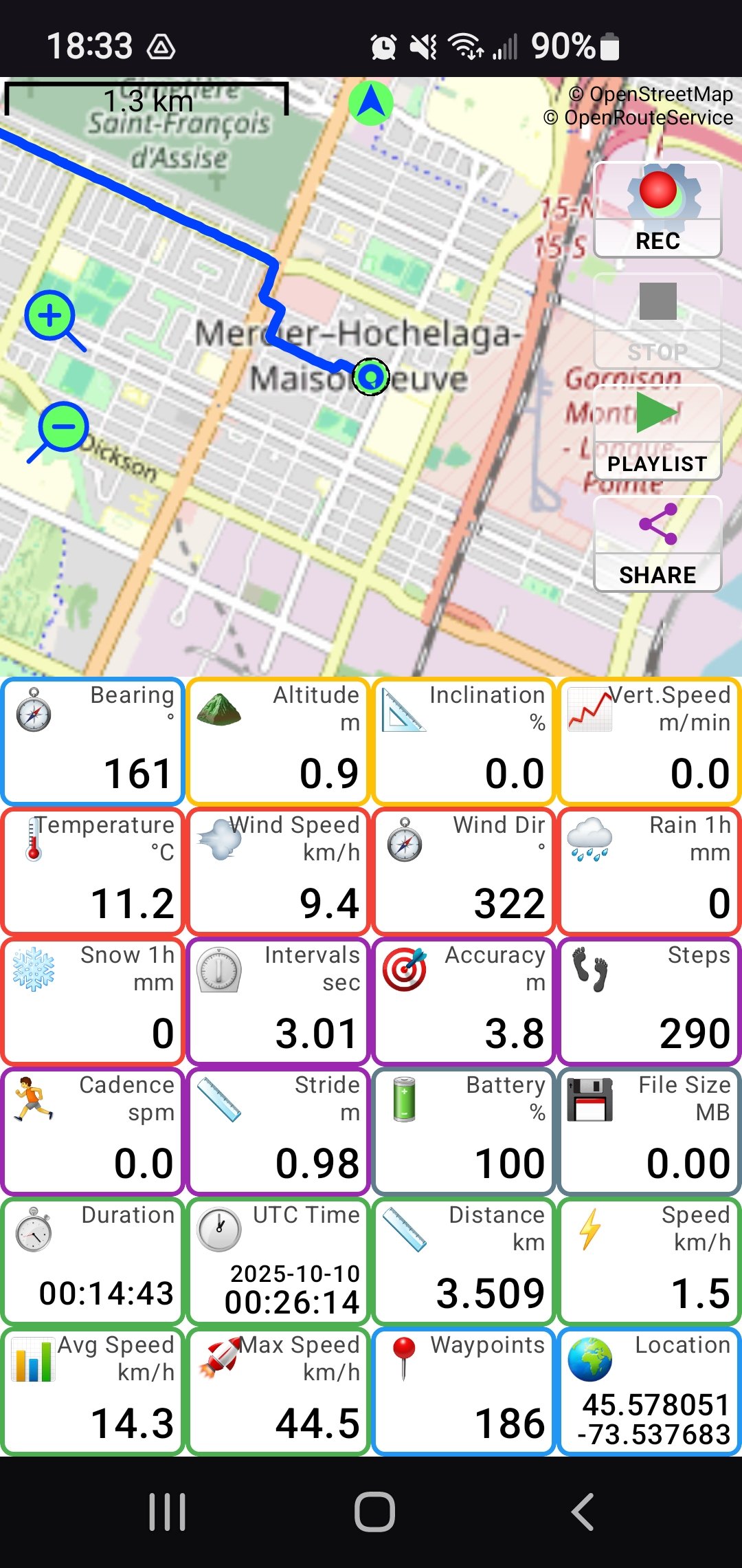
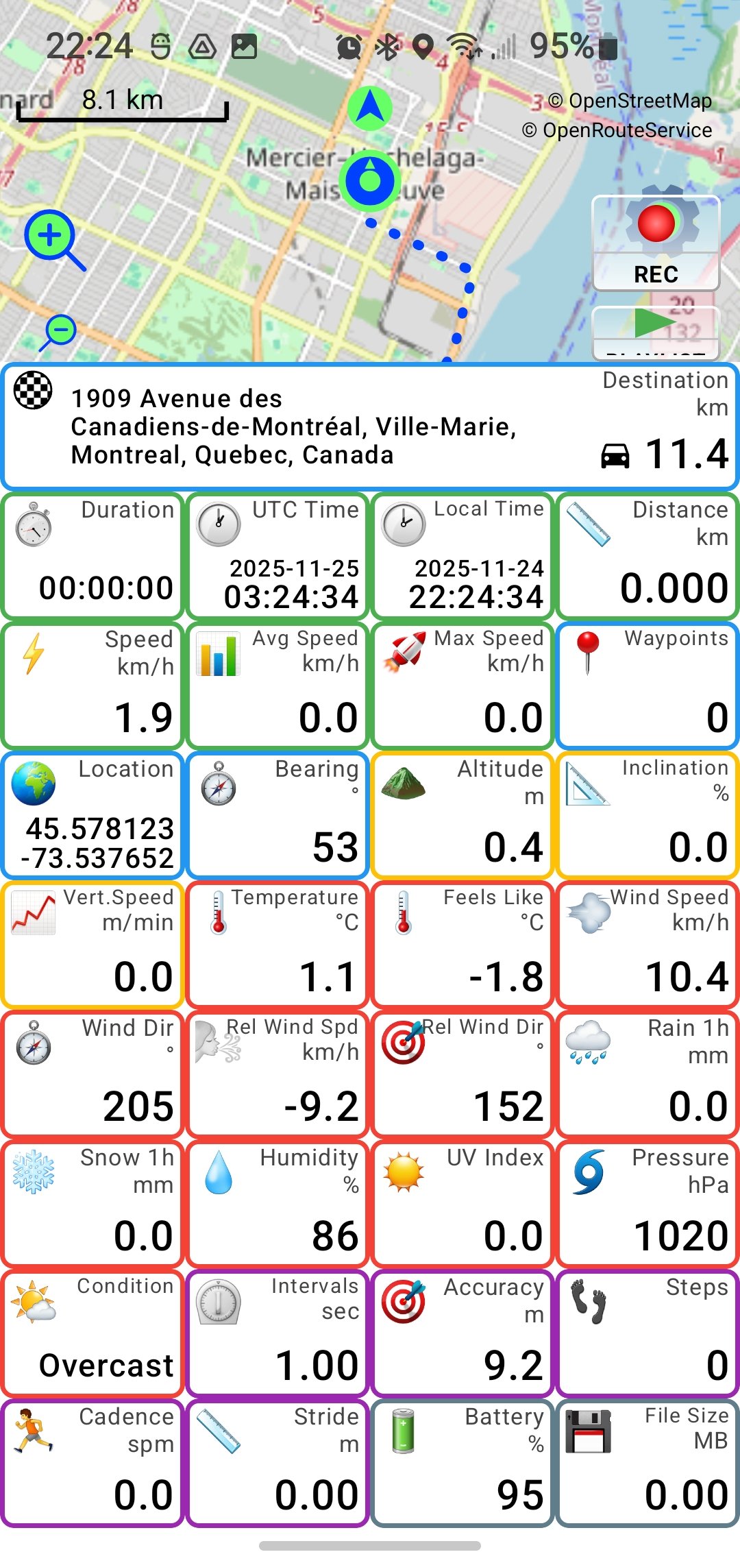
PathXplorer live tracking screen with map and dashboard tiles
50K+downloads on Google Play
25+live metrics on your dashboard
< 1 sGPS recording intervals
100%works offline — no data needed

A complete recording studio for your adventures

Hiking, motorcycling, driving, cycling, sailing, skiing — PathXplorer records it all and lets you relive it any way you want.

🛰️

Ultra-detailed tracking

High-accuracy recording with adjustable intervals and rock-solid background operation — never lose your route, even with the screen off.

📊

Your dashboard, your way

Build yours from a huge library of live tiles — drag to resize and reorder, double-tap any tile to copy its value. From 4 tiles to a full instrument panel.

🌦️

A full weather station

Live temperature and feels-like, wind with head/tailwind, conditions — plus humidity, rain, snow, UV and pressure recorded into every track.

🏍️

Lean angle gaugeFree

A real-time gauge with gyro auto-zeroing. See your live lean angle on the road — and again in your generated videos. Free for all riders.

🎯

G-Force meter

A live crosshair of acceleration, braking and cornering forces — recorded into your tracks and woven into your videos.

📸

Geotagged photos

Snap photos while recording — each is pinned to the exact spot on your route, appears on the map and drops into your videos where it was taken.

🎬

Cinematic track videos

Turn any track into a shareable video: a 15-second clip, a 60-second story, or a full-ride time-lapse at 10× or 60× speed.

📄

PDF trip reports

Any track becomes a beautifully laid-out PDF: route map with departure and arrival addresses, elevation, speed, lean angle and G-force — with 3D data maps.

👥

Live group tracking

Create or join a group with just a name — no account, no signup. Watch friends move on the map in real time. Private, encrypted, off by default.

🅿️

Parking spot memoryNew

PathXplorer notes where you parked automatically. Recent spots appear as map badges tagged with their street address — long-press to copy and text it to anyone.

🗺️

Maps, addresses & routing

Offline tile caching for areas with no signal, your nearest street address as a live tile, and route planning for walking, cycling or driving.

✈️

Your data, your rulesNew

Full Data, Eco or No Data mode — recording always uses zero mobile data, Wi-Fi unlocks everything, and a built-in meter shows exactly what the app used.

Emergency Ready

SOS — help on your terms

When something goes wrong far from help, every detail matters. Press and hold, then confirm — an alert never leaves your phone by accident. You pick exactly what to include.

  • Up to 3 contacts get an email with a live map — and can follow you live in the app.
  • Your exact location and nearest address — plus streets you recently passed.
  • Your recent trail — the last minutes of GPS track, so rescuers know your direction of travel.
  • Your latest photos — visual context of where you are.
  • Wi-Fi blocked? The alert retries over cellular automatically.
SOS

Press and hold, then confirm. A countdown prevents accidental triggers — then help is on the way.

See PathXplorer in action

Not a mockup, not a demo reel — a real ride, recorded by a real explorer, turned into this video by the app itself.

Recorded by Valérie

A sampan through the cliffs of Tràng An, Vietnam

Ten minutes on the river, recorded on her phone — then replayed and rendered by PathXplorer, frame for frame. Twelve live tiles roll past as the boat glides — time, address, duration, bearing, distance, elevation, speed, coordinates, steps, temperature, waypoints, wind — and seven of Valérie's photos drop in exactly where she took them.

Watch the details: the Address tile finding the way in Vietnamese, elevation sitting flat at river level, 33.7 °C in a light drizzle — and the step counter stuck at 7, because she was in a boat.

Been somewhere good? Send it over.

The best rides get featured right here — with your name on them, like Valérie's. Two ways to send one:

  • A YouTube link — if you've already generated and posted your video, that's all we need.
  • Or the ride itself, as a .pathx file. That's PathXplorer's own track format: your whole journey in one small file — every second of GPS, speed, elevation and weather data, plus your geotagged photos travelling with it. Straight from the app: tap SHARE then PathX File, pick your email app and send it to pathxplorer@funapps.biz. It's already packed and sized to fit an email. We'll replay your ride here — and build the video for you.
Tell us the name you'd like on the credit — a first name is plenty.

Send your ride →

or write to pathxplorer@funapps.biz

More rides on the PathXplorer YouTube channel

Built for the outdoors, designed for clarity

A clean map-first interface with instant access to everything — recording, playback, sharing and your full track history.

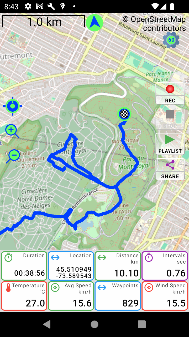
Recorded track across Mont-Royal park
Every curve of your route, captured
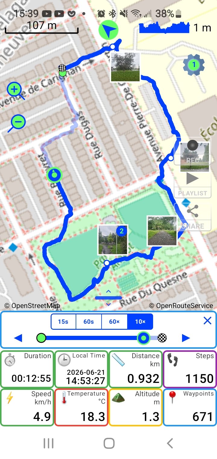
Track playback with geotagged photos and speed selector
Playback with geotagged photos
Full dashboard with destination address and weather tiles
The most detailed outdoor dashboard
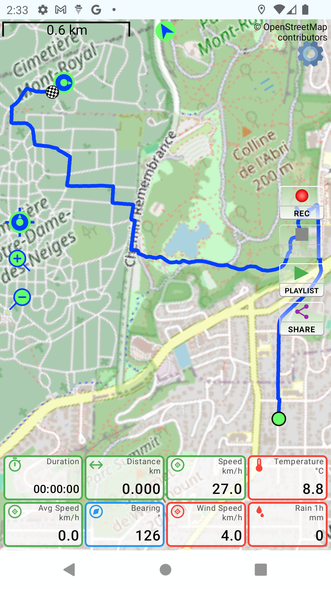
Dashboard with lean angle, G-force and weather tiles
Weather, motion, elevation — all live

Honest pricing. Seriously.

The full recording experience is free. The Fun upgrade costs about a penny a day — and your price is locked in forever.

Free

$0
forever — no account required
  • Ultra-detailed GPS recording
  • Customizable live dashboard
  • Lean angle gauge
  • Track playback & history
  • SOS emergency button
  • Parking spot memory
Download free

Fun

$3.65 / year
that's about 1¢ a day — priced fairly for your country
  • Everything in Free
  • G-Force meter
  • Premium dashboard tiles
  • Enhanced address features
  • Your renewal price never increases
  • Supports an independent developer
See what's in Fun

No ads. No data selling. Your tracks stay on your device unless you choose to share them.

PathXplorer app icon

Your next adventure deserves better than a breadcrumb trail.

Record it. Capture it. Relive it. Share it. Explore together — free.

Get it on Google Play